Image


The City of New Westminster provides an accessible, safe, and easy-to-navigate transportation system. We work with residents, experts, government officials, and surrounding municipalities to make sure our transportation network meets the needs of our growing community.
The City works with the following partners:
The BC Ministry of Transportation: Infrastructure and transportation plans, safety, regulations and other helpful information
TransLink: Transit schedules, route planning, updates and alerts
ICBC: Autoplans, insurance, license information
The Master Transportation Plan (MTP) was developed in consultation with the residents of New Westminster. It provides long-term guidance for transportation policies, priorities, and investments over the next 30 years and beyond. The MTP supports the City’s aims for compact, safe, and livable neighbourhoods, allowing a vibrant mix of activities.
There are several different groups of road users in our city. During the planning process, we follow a ‘hierarchy of modes’ that tells us the order in which each group should be considered.
This ensures that all road users, particularly vulnerable road users, are properly considered during transportation planning.
The MTP is guided by and supports other City policies and plans, and also takes into consideration regional and provincial plans.
The ATNP lays out a Core Network designed for people to get around by walking, cycling, or rolling. It connects major destinations, including commercial areas, City facilities like recreation centres, schools, parks, and interregional routes.
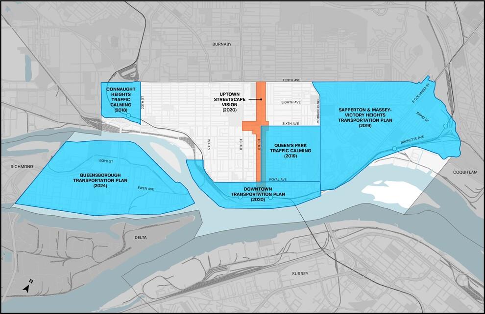
These plans provide guidelines and address needs that are unique to certain areas of New Westminster.
Timelines for completion can depend on:
Parking studies are completed to inform neighbourhood transportation plans and to guide long-term parking planning within the City.
The Intersection Network Screening Road Safety Review was completed in August 2023. It looked at how often accidents are happening at intersections throughout the city and how we can make intersections safer for all road users.
Completed in 2024, the Bus Speed and Reliability Hotspot Study looked at the City’s bus route network to find the areas where transit was most likely to be late or unreliable. The report also identified potential steps to improve reliability, including a five year action plan.